
Data Development and Organization
Scenario-based planning with SPM starts with a detailed baseline assessment of the existing conditions or base “canvas” at the Scenario Planning Zone (SPZ) level. The SPZs are the minimum unit of scenario planning and analysis that SCAG developed by grouping parcels of uniform or compatible land uses while maintaining manageable size for capturing local land use benefits on transportation, varied by development density and intensity.
SPM streamlines the development of the base canvas through scripts and processes that normalize data of varying quality, type and scale from a wide range of sources, including land cover and environmental data, demographic characteristics, roadway and transit that provide the foundation for analysis by SPM’s various analysis engines.
Scenario Development
The base canvas provides the context for scenario painting and editing, and subsequent analysis. Once the base canvas is set, scenarios can be created in two ways: translation of existing plans, and ‘painting’ or editing of new or existing plans or scenarios.
Existing Plan Translation
SPM analyzes existing plans or scenarios at any scale based on their key characteristics such as density, mix of uses, and street connectivity. It then translates each geographic area (e.g., parcel, TAZ, or SPZ) of the input plan into one of the model’s common language of Place Types and Building Types. Place Types represent a full range of potential development types and patterns, from urban mixed-use centers, to employment and industrial areas, to standard suburban residential areas that can be seen across the SCAG region. Each Place Type is composed of a mix of different building types and represents a unique set of assumptions that facilitate scenario modeling and testing at a variety of scales. This allows SCAG to integrate local plans together into a common regional fabric of land use and transportation plan and to perform consistent analysis on individual plans or combinations thereof.
Scenario Painting and Editing
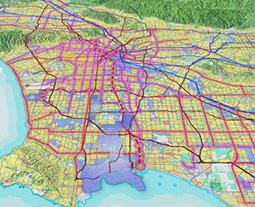
SPM’s web-based scenario painter, that includes a suite of selection and viewing tools, allows the user to edit or build upon a translated plan or scenario, or create new scenarios from scratch by applying Place Types to the landscape (see Figure below). In addition to various spatial data layers available via SPM’s graphical user interface, ranging from parcel level land use, to statewide resource areas and farmland, the web- based scenario painter can also display regularly updated data available on the web today (e.g., Google Maps, Open Street Map). SPM builds a scenario by adding the “change” or “increment” that you’ve painted on top of a base condition. The combination of the two produces what is known as the “End state” which represents what will be on the ground in the future.
Scenario Analysis
SPM analysis modules produce a wide range of inter-related metrics that allow for robust and meaningful comparisons of alternative land use and transportation scenarios. Once changes are made to the base canvas via painting or translation of existing plan, scenario core processes combine the changes or growth input with the existing conditions to create future scenarios and estimate developable land and demographic characteristics.
These scenarios then run through the model engines briefly described below to measure their performance for mobility, air quality, public health, fiscal impacts, resource consumptions, and others.