Modeling
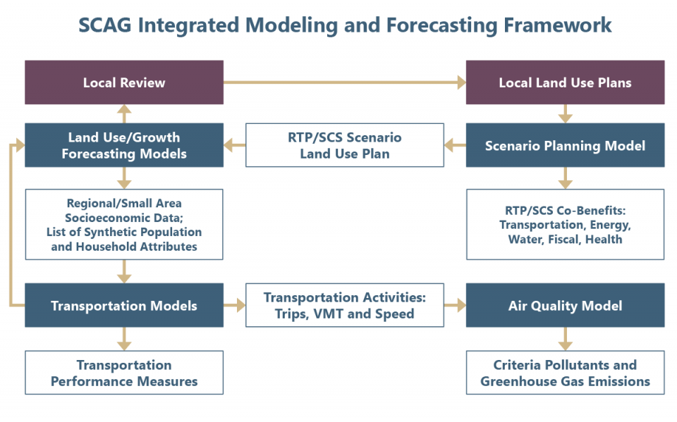
SCAG utilizes an integrated analytical framework to develop growth projections, travel forecasts, and emissions estimates to support the region’s various planning programs.
The primary functions of SCAG’s Modeling and Forecasting Department include:
- Working collaboratively with local jurisdictions to develop socioeconomic growth forecasts as required for regional and local planning.
- Providing modeling services for the development and implementation of SCAG’s plans, programs, and projects.
- Developing and maintaining SCAG’s various analytical tools and data to more effectively forecast travel demand and estimate resulting air quality.
- Providing member services through a robust subregional modeling and data distribution program.
- Promoting state-of-the-art modeling practices.
- Coordinating modeling activities within the SCAG region.
In addition, SCAG also maintains a robust subregional modeling and data service program essential to analyze many of the region’s projects and programs.
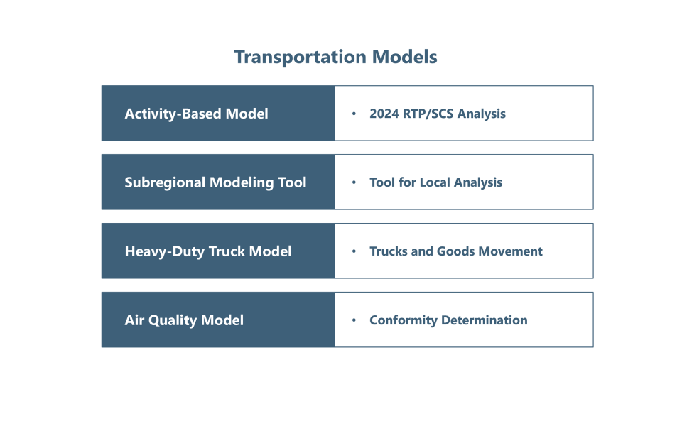
SCAG develops and applies state-of-the-art models to support SCAG’s planning programs. These models include:
- Activity-Based Model
- Air Quality Model
- Growth Forecast and Allocation Models
- Heavy-Duty Truck Model
- Land Use Model
- Scenario Planning Model
Member Services
SCAG maintains an active model and data distribution function for member agencies and other stakeholders. SCAG provides modeling data to support stakeholders’ planning programs and to assist in the development and maintenance of city and subregional models. SCAG provides modeling data services to member agencies, universities, and other public agencies by providing model setups, model input data, and model results.
SCAG’s model and data distribution program promotes model consistency, encourages sharing of model data between agencies, and greatly reduces costs for participating agencies. The use of models and data provided by SCAG helps ensure that local planning assumptions and modeling activities are consistent with SCAG’s models and growth assumptions. When local plans are consistent with SCAG’s plans, it guarantees that local planning input can feed seamlessly into the regional planning process. SCAG provides requestors off-the-shelf information or assistance in processing and extracting data. In addition, for subregional model development and large regional initiatives, SCAG provides model setups and documentation required for the requestor to set up and conduct modeling analysis.
To request modeling or forecasting data, complete the following:
For questions concerning modeling or forecasting data requests or to return the completed Data Request Form, please contact Cheryl Leising at (213) 236-1926 or email Leising@scag.ca.gov.
![]()
The SCAG Scenario Planning Model (SPM) is a comprehensive online land use sketch planning tool for data organization, scenario development, and modeling, developed to facilitate an informed and collaborative planning among counties, subregions, local jurisdictions, stakeholders, and the public.

SCAG develops and maintains state-of-the-art transportation models to support SCAG’s planning program. These models include: