High Injury Network: A Tool to Improve Safety in the Region

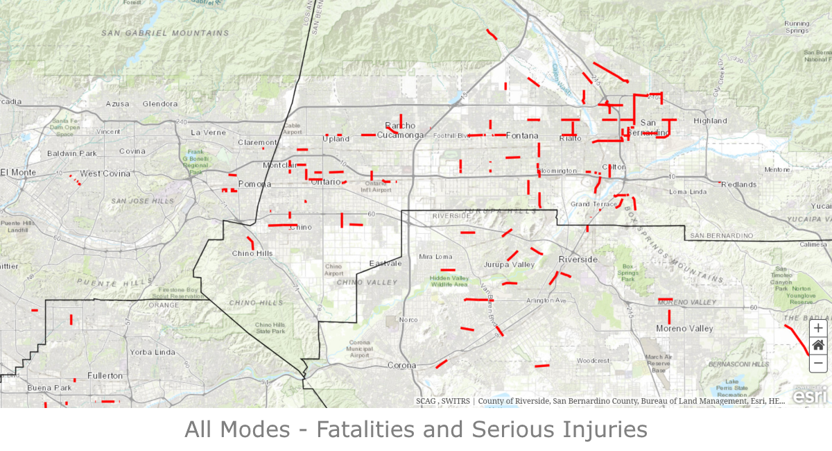
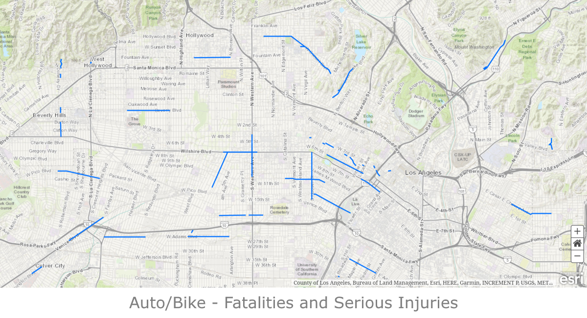
Traffic-related fatalities and serious injuries are a critical and preventable public health and equity issue in the region. Approximately 1,500 people die, more than 5,200 are severely injured, and 136,000 are injured on roadways throughout the SCAG region every year. These numbers represent children, parents, spouses, relatives, and friends. These are people who were going about their typical day—heading to work, the grocery store, or to visit family.
To help target resources where they are needed most, SCAG has developed a regional tool, the Regional High Injury Network (HIN). The HIN identifies stretches of roadways where the highest concentrations of collisions occur in the SCAG region, utilizing data across five years from the Transportation Injury Mapping System (TIMS), from 2010-2014.
Why the HIN is Useful
Here are some reasons why the HIN is useful and how a jurisdiction can use the HIN to advance safety. Jurisdictions can:
Ways to Improve Safety in the Region:
Whether you represent a jurisdiction in the SCAG region that is part of SCAG’s HIN or simply want to improve safety in your community, we want to work with you! Here are some options:
Commit to Safety with the SCAG Safety Pledge! Your city can choose to participate in a variety of ways depending on the unique needs of your community. Anything from adopting a Vision Zero plan, to hosting a pop-up safety demonstration, to implementing a safety outreach campaign can help make a difference.
Check out Go Human’s Safety Resources to learn more and improving safety in your community, through recorded webinars, workshops and other tools.
If your city has not already done so, consider developing a high injury network map at the local level to identify and prioritize safety improvements. Details on HIN mapping are provided in the draft Transportation Safety and Security technical report on the Connect SoCal Website.