IFF Case Studies
County of Los Angeles West Carson Enhanced Infrastructure Financing District (EIFD)
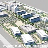 In May 2020, Los Angeles County approved a
Resolution of Intent to establish an EIFD in unincorporated West
Carson, making it one of the first County-initiated EIFDs in the
State. The goal of the West Carson EIFD is to fund the
development projects outlined in the 2019 West Carson Transit
Oriented District Specific Plan. The boundaries of the EIFD are
the I-110 highway to the east, Normandie Avenue to the west, Del
Amo Boulevard to the north, and Lomita Boulevard to the south.
The West Carson EIFD is one of SCAG’s most recent Pilot TIF
projects.
In May 2020, Los Angeles County approved a
Resolution of Intent to establish an EIFD in unincorporated West
Carson, making it one of the first County-initiated EIFDs in the
State. The goal of the West Carson EIFD is to fund the
development projects outlined in the 2019 West Carson Transit
Oriented District Specific Plan. The boundaries of the EIFD are
the I-110 highway to the east, Normandie Avenue to the west, Del
Amo Boulevard to the north, and Lomita Boulevard to the south.
The West Carson EIFD is one of SCAG’s most recent Pilot TIF
projects.
Utilizing tax increment collected above the 2021 base year, the West Carson EIFD will fund pedestrian improvement and connectivity, utility upgrades, and landscaping and green space improvements to the BioTech park. Additionally, the County intends to deposit 20% of tax increment funds into the Affordable Housing Trust Fund to go towards affordable housing development. The West Carson EIFD term is 45 years, although it is projected to incur $41 million in funds for the County over the course of 50 years. The West Carson EIFD can contribute up to $120 million to the Affordable Housing Trust Fund, and generate $1.2 billion in economic output yearly.
With a fully formed Public Financing Authority (PFA) made up of Los Angeles County Supervisors and the draft Infrastructure Financing Plan (IFP) currently under review, the West Carson EIFD is anticipated to be approved by early 2021.
Official information on the EIFD can be found at
https://pw.lacounty.gov/pdd/proj/westcarson-eifd/
RELEVANT TOOLS
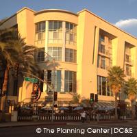
City of Placentia/County of Orange Enhanced Infrastructure Financing District (EIFD)
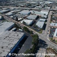 The Placentia EIFD will fund
transit-supportive and housing-supportive infrastructure in the
communities directly to the north and south of the upcoming
Placentia Metrolink Station, which will serve communities along
State Route 91 – one of the busiest and most congest
transportation corridors in Southern California. Specific
improvements will include street upgrades, lighting
infrastructure, pedestrian connectivity, as well as sewer and
water infrastructure enhancements to increase housing capacity,
as well as upgrades to the landscape. These investments are
estimated to cost around $8 million, and will support an
additional 1,600 housing units, 3,900 construction jobs, 1,150
permanent jobs that can help generate $800 million in economic
output from construction activities, and $164 million in annual
ongoing economic output.
The Placentia EIFD will fund
transit-supportive and housing-supportive infrastructure in the
communities directly to the north and south of the upcoming
Placentia Metrolink Station, which will serve communities along
State Route 91 – one of the busiest and most congest
transportation corridors in Southern California. Specific
improvements will include street upgrades, lighting
infrastructure, pedestrian connectivity, as well as sewer and
water infrastructure enhancements to increase housing capacity,
as well as upgrades to the landscape. These investments are
estimated to cost around $8 million, and will support an
additional 1,600 housing units, 3,900 construction jobs, 1,150
permanent jobs that can help generate $800 million in economic
output from construction activities, and $164 million in annual
ongoing economic output.
To reach district formation, the process was initiated when the City of Placentia approved a Resolution of Intent on February 19, 2019 supporting the establishment of an EIFD in the areas surrounding the upcoming station, including the Old Town Placentia Area as well as the Transit Oriented Development Packing House District. The Orange County Board of Supervisors evaluated and supported a similar resolution on April 23, 2019. The City of Placentia / County of Orange EIFD was then established in September 2019 and became the first city/county EIFD partnership in California, when the District’s Public Financing Authority (PFA) officially approved its Infrastructure Financing Plan (IFP). The Placentia EIFD is one of SCAG’s Pilot TIF projects. Visually explore the Placentia EIFD through the City of Placentia EIFD Story Map.
Official information on the EIFD can be found at
https://www.placentia.org/860/Enhanced-Infrastructure-Financing-Distri
RELEVANT TOOLS
City of La Verne/County of Los Angeles Enhanced Infrastructure Financing District (EIFD)
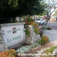 In 2017, the City of La Verne passed a
Resolution of Intent to establish an EIFD at the future Metro
Gold Line light rail station (E Street and Arrow Highway) and
surrounding transit-oriented development as outlined in the Old
Town La Verne Specific Plan. Property tax increment is projected
to generate $33 million, and will go towards funding multiple
infrastructure projects, including enhancement of connectivity
(parking, pedestrians, bikes, rideshare), beautification, and
expansion of utilities to catalyze development and accommodate
housing growth. Private development projects include 1,700 new
residential units 15% of which are affordable, retail, a business
park, and hotel transit-oriented development are also valued at
nearly $500 million in 2017 dollars.
In 2017, the City of La Verne passed a
Resolution of Intent to establish an EIFD at the future Metro
Gold Line light rail station (E Street and Arrow Highway) and
surrounding transit-oriented development as outlined in the Old
Town La Verne Specific Plan. Property tax increment is projected
to generate $33 million, and will go towards funding multiple
infrastructure projects, including enhancement of connectivity
(parking, pedestrians, bikes, rideshare), beautification, and
expansion of utilities to catalyze development and accommodate
housing growth. Private development projects include 1,700 new
residential units 15% of which are affordable, retail, a business
park, and hotel transit-oriented development are also valued at
nearly $500 million in 2017 dollars.
Although initially the City established the EIFD without County participation, in January 2020, the Los Angeles County Board of Supervisors approved the County’s financial participation in the La Verne EIFD. With the County’s participation, the EIFD will receive an additional $50 million in tax increment funds. The La Verne EIFD Infrastructure Financing Plan was approved August of 2020, making it the second EIFD in the State to involve a city and county partnership.
Official information on the EIFD can be found at
https://www.cityoflaverne.org/index.php/home/bulletins/287-socalgas-requests-regulatory-approval-to-replenish-natural-gas-supply-at-aliso-canyon-storage-facility
RELEVANT TOOLS
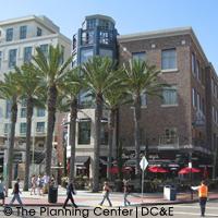
City of San Diego Otay Mesa Enhanced Infrastructure Financing District (EIFD)
 In 2017, the City of San Diego established
an EIFD at the Otay Mesa community. The goal of the Otay Mesa
EIFD is to fund and implement the priorities and projects
outlined in the Otay Mesa Community Plan and the Otay Mesa Public
Facilities Financing Plan. The Otay Mesa EIFD is coterminous with
the Otay Mesa Community Plan Area, with the Otay River Valley and
city of Chula Vista to the north, the Mexican border and city of
Tijuana to the south, a County of San Diego unincorporated area
to the east, and I-805 highway to the west as boundaries.
In 2017, the City of San Diego established
an EIFD at the Otay Mesa community. The goal of the Otay Mesa
EIFD is to fund and implement the priorities and projects
outlined in the Otay Mesa Community Plan and the Otay Mesa Public
Facilities Financing Plan. The Otay Mesa EIFD is coterminous with
the Otay Mesa Community Plan Area, with the Otay River Valley and
city of Chula Vista to the north, the Mexican border and city of
Tijuana to the south, a County of San Diego unincorporated area
to the east, and I-805 highway to the west as boundaries.
Using tax increment collected above the base 2017 year, the Otay Mesa EIFD will fund economic development, infrastructure development, and public facility improvements. These projects include housing development, economic development near the airport, public facility improvements (transportation, park, water & sewer) and industrial infrastructure development. The Otay Mesa EIFD is projected to bring in $970 million over the course of its life. The Otay Mesa EIFD Infrastructure Financing Plan was approved in June of 2017.
Official information on the EIFD can be found at
https://www.sandiego.gov/council-committees/omeifd
RELEVANT TOOLS
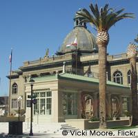
City of West Sacramento Enhanced Infrastructure Financing District (EIFD)
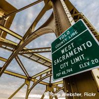 In 2017, the City of West Sacramento
became the first city in California to establish an EIFD. The
West Sacramento EIFD encompasses 25%, or 4,144 acres, of the City
of West Sacramento near the City’s Port and waterfront area. At
the time of formation, the West Sacramento EIFD covered 14
subareas that had riverfront mixed-use development, industrial
districts, retail districts, and contained redevelopment areas.
In 2017, the City of West Sacramento
became the first city in California to establish an EIFD. The
West Sacramento EIFD encompasses 25%, or 4,144 acres, of the City
of West Sacramento near the City’s Port and waterfront area. At
the time of formation, the West Sacramento EIFD covered 14
subareas that had riverfront mixed-use development, industrial
districts, retail districts, and contained redevelopment areas.
Utilizing tax increment captured above the baseline year of 2016-2017 and remaining Redevelopment funds, the West Sacramento EIFD is funding public facility improvements, economic development near the City’s waterfronts, and housing with the goal of increasing commercial and mixed-use development in this area. With the City being the only taxing entity in the EIFD, the West Sacramento EIFD is projected to generate $535 million, in 2017 dollars, over the course of its life.
Official information on the EIFD can be found at
https://www.cityofwestsacramento.org/business/economic-development/enhanced-infrastructure-financing-districts
RELEVANT TOOLS
City of Redondo Beach Enhanced Infrastructure Financing District (EIFD)
 In May 2019, the City of Redondo Beach
approved a Resolution of Intent to establish an EIFD at its
now-closed AES Power Plant. Following the City’s Resolution of
Intent, the County of Los Angeles also approved a Resolution of
Intent to partner with the City to form the Redondo Beach EIFD in
November of 2019. The Redondo Beach EIFD is proposed to revert
the Power Plant’s 50-acre site into open space and park
development, wetland restoration, and private development. The
assessed value of the development on the area is $265 million.
The Redondo Beach EIFD’s term is 45 years, although it is
projected to incur over $71 million in revenue over the course of
50 years. Not only will these funds go towards developing park
and wetland space, but will also fund circulation improvements
(streets, parking, and coastal access) and site remediation. As
of December 2020, the Redondo Beach EIFD’s Infrastructure
Financing Plan is currently under review. With the County’s
participation, it will soon become the third formed EIFD in the
State to involve a city and county partnership.
In May 2019, the City of Redondo Beach
approved a Resolution of Intent to establish an EIFD at its
now-closed AES Power Plant. Following the City’s Resolution of
Intent, the County of Los Angeles also approved a Resolution of
Intent to partner with the City to form the Redondo Beach EIFD in
November of 2019. The Redondo Beach EIFD is proposed to revert
the Power Plant’s 50-acre site into open space and park
development, wetland restoration, and private development. The
assessed value of the development on the area is $265 million.
The Redondo Beach EIFD’s term is 45 years, although it is
projected to incur over $71 million in revenue over the course of
50 years. Not only will these funds go towards developing park
and wetland space, but will also fund circulation improvements
(streets, parking, and coastal access) and site remediation. As
of December 2020, the Redondo Beach EIFD’s Infrastructure
Financing Plan is currently under review. With the County’s
participation, it will soon become the third formed EIFD in the
State to involve a city and county partnership.
Official information on the EIFD can be found at https://www.redondo.org/
RELEVANT TOOLS
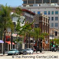
City of Fresno Enhanced Infrastructure Financing District (EIFD)
 In April of 2020, the City of Fresno
approved a Resolution of Intent to establish an EIFD at Downtown
Fresno and the southern portion of the Blackstone Avenue Bus
Rapid Transit area. With a focus on transportation improvements
and investment, the Fresno EIFD will fund transportation safety
and accessibility improvements, increased investment in bus
infrastructure and roadways, streetscape and lighting
improvements, improved wayfinding signage, and economic
development projects. Collecting tax increment above the base
2021/2022 year, the Fresno EIFD is projected to incur $9.9
million in revenue over the course of 45 years. The Fresno EIFD
will support the development of 10,000 housing units, over 22,000
in temporary construction jobs and 1,225 in permanent jobs, $3.6
billion in economic output from construction activities, and $211
million in annual economic output. The Fresno EIFD Public
Financing Authority approved the District’s Infrastructure
Financing Plan in October of 2020, making it the fifth EIFD in
the State.
In April of 2020, the City of Fresno
approved a Resolution of Intent to establish an EIFD at Downtown
Fresno and the southern portion of the Blackstone Avenue Bus
Rapid Transit area. With a focus on transportation improvements
and investment, the Fresno EIFD will fund transportation safety
and accessibility improvements, increased investment in bus
infrastructure and roadways, streetscape and lighting
improvements, improved wayfinding signage, and economic
development projects. Collecting tax increment above the base
2021/2022 year, the Fresno EIFD is projected to incur $9.9
million in revenue over the course of 45 years. The Fresno EIFD
will support the development of 10,000 housing units, over 22,000
in temporary construction jobs and 1,225 in permanent jobs, $3.6
billion in economic output from construction activities, and $211
million in annual economic output. The Fresno EIFD Public
Financing Authority approved the District’s Infrastructure
Financing Plan in October of 2020, making it the fifth EIFD in
the State.
Official information on the EIFD can be found at
https://www.fresno.gov/darm/housing-community-development/#tab-10
RELEVANT TOOLS
Resilient and Sustainable Infrastructure
 EIFDs can also be utilized to fund
emerging climate change resilience strategies, such as
Climate-Safe Infrastructure. This section will provide some
background on and discuss how EIFDs could serve as a financing
tool for Climate-Safe Infrastructure.
EIFDs can also be utilized to fund
emerging climate change resilience strategies, such as
Climate-Safe Infrastructure. This section will provide some
background on and discuss how EIFDs could serve as a financing
tool for Climate-Safe Infrastructure.
Background
With the State facing increasing temperatures, extreme heat waves, rising sea levels, and longer wildfire seasons, it is imperative that California’s cities and counties are adaptive and resilient to this changing climate. The State has passed several legislative measures to incorporate climate change considerations in local planning, such as Senate Bill (SB) 379 which requires cities and counties to incorporate climate adaptation strategies in their Safety Elements and Senate Bill 1035 which modifies SB 379’s timeline so that data on climate adaptation in Safety Elements is regularly updated. Additionally, Senate Bill (SB) 1241 requires jurisdictions to consider fire hazards, especially in communities or unincorporated communities in the state responsibility areas that are in high fire severity areas. Assembly Bill 2911 strengthened SB 1241’s local very high fire severity designation areas.
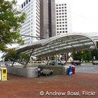
San Francisco Treasure Island Infrastructure and Revitalization Financing District (IRFD)
 In 2017, the City of San Francisco
established the Treasure Island IRFD at Treasure Island and Yerba
Buena Island, which are nestled between the cities of San
Francisco and Oakland. The Treasure Island IRFD is overseen by
the City and the Treasure Island Development Authority (TIDA),
who is made up of members from the City of San Francisco’s Board
of Supervisors. Drawing from tax increment as well as funds from
a Community Facilities District (CFD), the Treasure Island IRFD
will go towards funding housing development, commercial and
retail development, public infrastructure improvement (streets,
utilities, community facilities, etc.), park/open space
maintenance, and geotechnical improvements.
In 2017, the City of San Francisco
established the Treasure Island IRFD at Treasure Island and Yerba
Buena Island, which are nestled between the cities of San
Francisco and Oakland. The Treasure Island IRFD is overseen by
the City and the Treasure Island Development Authority (TIDA),
who is made up of members from the City of San Francisco’s Board
of Supervisors. Drawing from tax increment as well as funds from
a Community Facilities District (CFD), the Treasure Island IRFD
will go towards funding housing development, commercial and
retail development, public infrastructure improvement (streets,
utilities, community facilities, etc.), park/open space
maintenance, and geotechnical improvements.
While funds from the CFD go primarily towards the proposed park, open space maintenance, and geotechnical improvements, the funds generated from the IRFD go primarily towards the proposed housing, economic development, and property improvements.
Official information on the IRFD can be found at https://sftreasureisland.org/
RELEVANT TOOLS
Emery-Go-Round
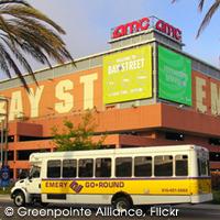 The Emery-Go-Round is a free local
circulator system that annually shuttles 1.3 million commuters
and residents between Emeryville and the Bay Area Rapid Transit
(BART) MacArthur Station. The shuttle service represents the
culmination of a partnership formed between the City of
Emeryville and a constituency of local corporations that began in
1996. The shuttle service provides an example of the efficacy of
coordinated private sector investment in providing reliable,
nonautomotive commute options. It is funded by a Property-Based
Business Improvement District (PBID), whereby business owners
have elected to pay a small assessment on commercial square
footage to support the shuttle’s operation. Although the project
was initially proposed and planned by city staff, the city’s role
in funding and operation was phased out in the first 3 years of
operation, and the shuttle has operated successfully for 15 years
with very little assistance from the local redevelopment agency.
The Emery-Go-Round is a free local
circulator system that annually shuttles 1.3 million commuters
and residents between Emeryville and the Bay Area Rapid Transit
(BART) MacArthur Station. The shuttle service represents the
culmination of a partnership formed between the City of
Emeryville and a constituency of local corporations that began in
1996. The shuttle service provides an example of the efficacy of
coordinated private sector investment in providing reliable,
nonautomotive commute options. It is funded by a Property-Based
Business Improvement District (PBID), whereby business owners
have elected to pay a small assessment on commercial square
footage to support the shuttle’s operation. Although the project
was initially proposed and planned by city staff, the city’s role
in funding and operation was phased out in the first 3 years of
operation, and the shuttle has operated successfully for 15 years
with very little assistance from the local redevelopment agency.
RELEVANT TOOLS
White Flint Sector Plan
 White Flint is in North Bethesda, an
urbanized area in Montgomery County, Maryland. The White Flint
Sector Plan covers 430 acres within a 4-mile radius of the White
Flint Metrorail station, part of the rapid transit system
operated by the Washington Metropolitan Area Transit Authority.
To support significant new residential and commercial
development, the sector plan identified $313.4 million worth of
infrastructure and public facility needs.
White Flint is in North Bethesda, an
urbanized area in Montgomery County, Maryland. The White Flint
Sector Plan covers 430 acres within a 4-mile radius of the White
Flint Metrorail station, part of the rapid transit system
operated by the Washington Metropolitan Area Transit Authority.
To support significant new residential and commercial
development, the sector plan identified $313.4 million worth of
infrastructure and public facility needs.
This case study focuses on the provisions in the plan related to implementation and financing of the proposed infrastructure and public facility projects, and describes how implementation has actually progressed since the plan was adopted in early 2010. The White Flint Sector Plan is an excellent example of a comprehensive plan for transit-oriented development with a strong focus on implementation. Montgomery County’s experience also illustrates the challenges that can be involved in financing complex infrastructure and public facility projects, even with a well-thought-out plan.
RELEVANT TOOLS
West Dublin BART
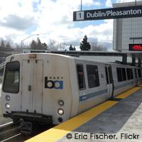 The West Dublin Bay Area Rapid Transit
(BART) station opened in February 2011 after a nearly 15-year
effort to fund and construct the station. The station is in
suburban Alameda County, on the border between the towns of
Dublin and Pleasanton. The West Dublin station was completed as
an “infill” station between the Dublin/Pleasanton and Castro
Valley stations, a ten-mile stretch of the BART line with no
stops. The construction of the West Dublin Station provides a
unique example of using joint development as a value capture
strategy to fund the construction of a rail station and the
provision of TOD infrastructure.
The West Dublin Bay Area Rapid Transit
(BART) station opened in February 2011 after a nearly 15-year
effort to fund and construct the station. The station is in
suburban Alameda County, on the border between the towns of
Dublin and Pleasanton. The West Dublin station was completed as
an “infill” station between the Dublin/Pleasanton and Castro
Valley stations, a ten-mile stretch of the BART line with no
stops. The construction of the West Dublin Station provides a
unique example of using joint development as a value capture
strategy to fund the construction of a rail station and the
provision of TOD infrastructure.
RELEVANT TOOLS
Greater University Circle
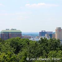 University Circle is a square-mile
district about four miles east of downtown Cleveland that is home
to approximately 40 education, health, arts, and social services
institutions. Since the 1950s, the University Circle institutions
have worked together to plan the development of the Circle,
acquire land, and provide services such as landscaping, policing,
and marketing through an organization called University Circle,
Inc. In 2005, the Cleveland Foundation initiated a new effort to
bring the district’s institutions together to address critical
infrastructure needs and revitalize the surrounding “greater”
University Circle neighborhoods. Through these two efforts, the
institutions in University Circle have contributed to
infrastructure development in a number of ways – including
providing up-front money to pay for design and planning,
supporting grant applications, and even taking the lead in
raising funding and constructing streetscape and other
improvements. This case study reviews the range of ways that
anchor institutions have contributed to infrastructure and
transit-oriented development in the Circle.
University Circle is a square-mile
district about four miles east of downtown Cleveland that is home
to approximately 40 education, health, arts, and social services
institutions. Since the 1950s, the University Circle institutions
have worked together to plan the development of the Circle,
acquire land, and provide services such as landscaping, policing,
and marketing through an organization called University Circle,
Inc. In 2005, the Cleveland Foundation initiated a new effort to
bring the district’s institutions together to address critical
infrastructure needs and revitalize the surrounding “greater”
University Circle neighborhoods. Through these two efforts, the
institutions in University Circle have contributed to
infrastructure development in a number of ways – including
providing up-front money to pay for design and planning,
supporting grant applications, and even taking the lead in
raising funding and constructing streetscape and other
improvements. This case study reviews the range of ways that
anchor institutions have contributed to infrastructure and
transit-oriented development in the Circle.
RELEVANT TOOLS
The Burbank Collection Community Facilities District
 The Burbank Collection is an $80 million
project in downtown Burbank that includes 40,000 square feet of
urban retail space, 118 condominiums, and a 723-space parking
garage that provides parking for residents, retail customers, and
the public. Champion Real Estate Companies, the developer built
the garage as part of the larger project. The city then purchased
the public component of the garage from the developer using the
proceeds of a bond issuance backed by a combination of
tax-increment financing and a community facilities district
special tax.
The Burbank Collection is an $80 million
project in downtown Burbank that includes 40,000 square feet of
urban retail space, 118 condominiums, and a 723-space parking
garage that provides parking for residents, retail customers, and
the public. Champion Real Estate Companies, the developer built
the garage as part of the larger project. The city then purchased
the public component of the garage from the developer using the
proceeds of a bond issuance backed by a combination of
tax-increment financing and a community facilities district
special tax.
This case study discusses how the publicly owned component of the garage was financed and how it is managed today, including the challenges involved in managing this type of shared-ownership, shared-access parking.
RELEVANT TOOLS
Centre City Downtown Parking Management
For 15 years San Diego’s Centre City has pursued an innovative, multitiered parking management district strategy that uses local resources to generate revenue and alleviate parking demand. Parking management in Centre City has benefitted from the city’s long-term strategy for allocating parking revenues. Centre City has used a two-pronged approach to alleviating demand issues; first, smart meters were implemented to increase on-street parking occupancy and two parking structures were built in areas with chronic parking shortages. Meter revenues financed the construction of the structures.
RELEVANT TOOLS
Redwood City Downtown Meter Zone
Over the past five years Redwood City has taken an aggressive approach to satisfying its downtown parking demand. To manage the area’s existing parking options – including on-street meters and multiple public and private garages – Redwood City developed a parking management district: the Downtown Meter Zone Program. The program altered rates and time limits for metered parking in downtown to stimulate more patron turnover, generate more revenue from the existing supply, and ensure efficient use of parking spaces. This program coincided with the development of a major retail/cinema center in the area for which the Redwood City Redevelopment Agency financed a 590-space underground garage. Downtown Redwood City demonstrates that a coordinated policy that uses both on-street and garage spaces and that builds off existing assets can be an effective strategy.
RELEVANT TOOLS
Old Pasadena Parking Management Zone
Old Pasadena’s parking management strategy is one of the most frequently cited examples of a multipronged approach to alleviating parking issues and funding improvements in the Southern California region. Innovative parking strategies have assisted the revival of Old Pasadena as a commercial destination, and the area is now one of the most vibrant downtowns in the region. In the early 1990s, the city devised two creative parking policies to fund downtown improvements and mitigate future parking congestion. First, the city reinstalled parking meters in the downtown and used meter revenues to finance local improvements, establishing a parking management district with a local citizen advisory board that set meter rates and enacted parking policy in the district. The net revenues of the program financed a number of streetscape improvements that improved the commercial viability of Old Pasadena. Secondly, a parking credit program for commercial property owners satisfied off-street parking requirements in three downtown public parking structures. In 2004, the Old Pasadena Management District assumed control of the administration and management of the structures. Proactive management strategies have helped boost garage occupancy rates, an added benefit to the local merchant community.
RELEVANT TOOLS
Aurora Strategic Parking Plan and Program
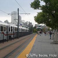 The City of Aurora in the Denver metro
area recently completed a “Strategic Parking Plan and Program
Study” that is an innovative parking management strategy for the
planned I-225 light rail corridor, including a corridor-based
strategy for financing structured parking. The study envisions
implementing fees for parking as well as other parking management
tools along the entire light rail corridor, including the transit
station parking lots and surrounding residential and commercial
parking areas. By managing the parking supply and implementing
fees across a broad geographic area, the measures described in
the study could create a market for priced parking (i.e.,
eliminate the option for free parking on the street) and raise
revenue to pay for new parking structures at targeted stations.
The Aurora study demonstrates the range of parking, management,
pricing, and other revenue generating tools that could be
included, as well as the challenges involved in implementing this
type of corridor-level parking strategy.
The City of Aurora in the Denver metro
area recently completed a “Strategic Parking Plan and Program
Study” that is an innovative parking management strategy for the
planned I-225 light rail corridor, including a corridor-based
strategy for financing structured parking. The study envisions
implementing fees for parking as well as other parking management
tools along the entire light rail corridor, including the transit
station parking lots and surrounding residential and commercial
parking areas. By managing the parking supply and implementing
fees across a broad geographic area, the measures described in
the study could create a market for priced parking (i.e.,
eliminate the option for free parking on the street) and raise
revenue to pay for new parking structures at targeted stations.
The Aurora study demonstrates the range of parking, management,
pricing, and other revenue generating tools that could be
included, as well as the challenges involved in implementing this
type of corridor-level parking strategy.
RELEVANT TOOLS
- Development Impact Fees
- Special Assessment District
- User Fees
- Revenue Bonds